General History of Indian Key
Maps of Indian Key and the Tropical Hotel
By Jerry Wilkinson
From my participation in decades of Indian Key events, festivals, etc. most maps of the 1840 description have been derivations of two basic maps from the National Archives - one with streets and one without streets. This is far too simple of a distinction, but will generally serve the purpose. In fact, I have never seen the two that I have used exactly as exists. I suggest that this page will generate more questions than it will resolve.
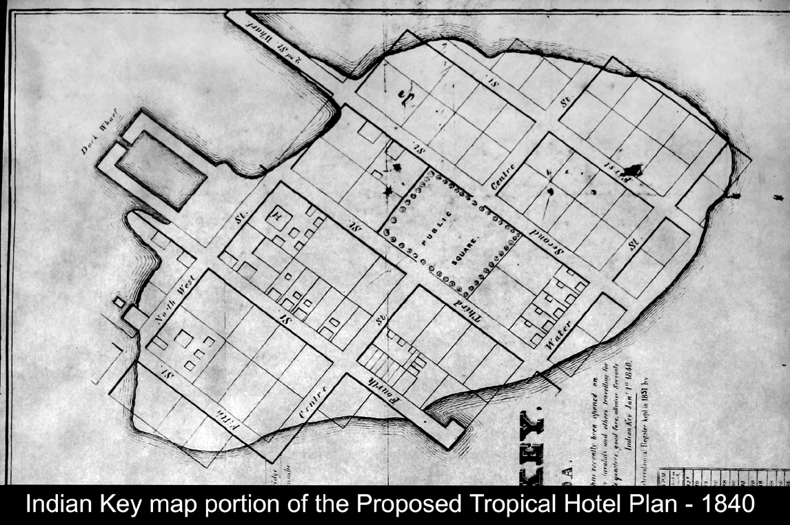
I will began with the more complex of the two and is shown belowand right - all images will enlarge by left clicking the image. First I wish to point out it has a signature, or creator, noted at the lower right corner - "Bufford's Lith NY."
I note four parts to this map: 1) The left side which is an excellent representation of the area in 1840 with the exceptions of the names used for Upper [N.E.] and Lower [S.W.] Matecumbe Keys. but is descriptive enough. Long Isle was used for Plantation Key and Viper Key for Long Key. Dr. Perrine's plantation area is correctly shown in the Cape Sable area and not in Dade County. Two distance lines point to Havana and Matanzas, Cuba.
2) The very bottom center is a chart of average monthly temperatures based on Charles Howe's 1837 recordings.
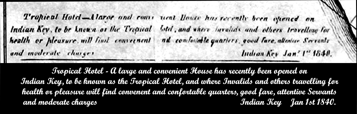
3) Above the temperature chart is the stated purpose of the chart. I note the clauses "...recently opened..." and "...will find..." meaning that this is a proposal and not an existing fact. Below is the actual portion followed by my transcription. Note the vertical blank space in the center as if this copy from the National Archives may have been manipulated.
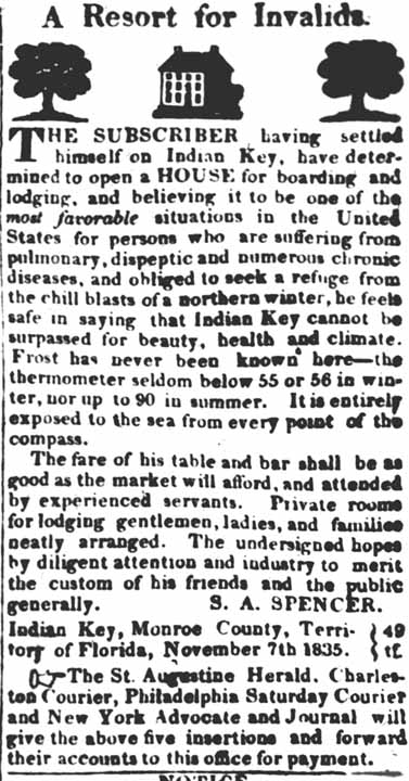
4) Now to the map of the island of Indian Key. One thing it is outlined as if it was a subdivision map - right-of-ways for streets and rectangles for the real estate lots, and within each lot a square representing a structure - small squares are usually out-houses. Please click here for a moment and note that the properties at the court house only annotated structures and not the actual lot of land number. After this quick reference use the green arrow and return here. Continuing, the county records that you references were those of Monroe County, and this 1840 map is of Dade County (1836) and Indian Key was its county seat; therefore, we do not know the accuracy or legality of this map. Remember that the person doing the Florida media advertising was a S. A. Spence, I have no idea who he was, or his representation - click here to read one. Also the date in this ad is November 7, 1835 - three and a half years after James Audubon visited.
I will show a small version of the map to the right: As with all you can enlarge by left clicking the image. One of the curious things I cropped off but a portion survived. At the bottom-left just below the intersection of Centre and Fifth Streets are two vertical dashed lines and ll that can be read of two words is; "idge" and "umbe.' The complete text is: "Proposed Bridge to Old Matecumbe." 'Old Matecumbe Key" then was a typical name for today's Lower Matecumbe Key and shown on their map portion to the left as "S.W. Matecumbe. My suggestion is that the large, better known and closer artesian fresh water wells were on northern Lower Matecumbe (Old) Matecumbe Key, not to mention that Dr. Perrine had his plant beds there. Railroads and highways won't arrive for another 70/80 years.
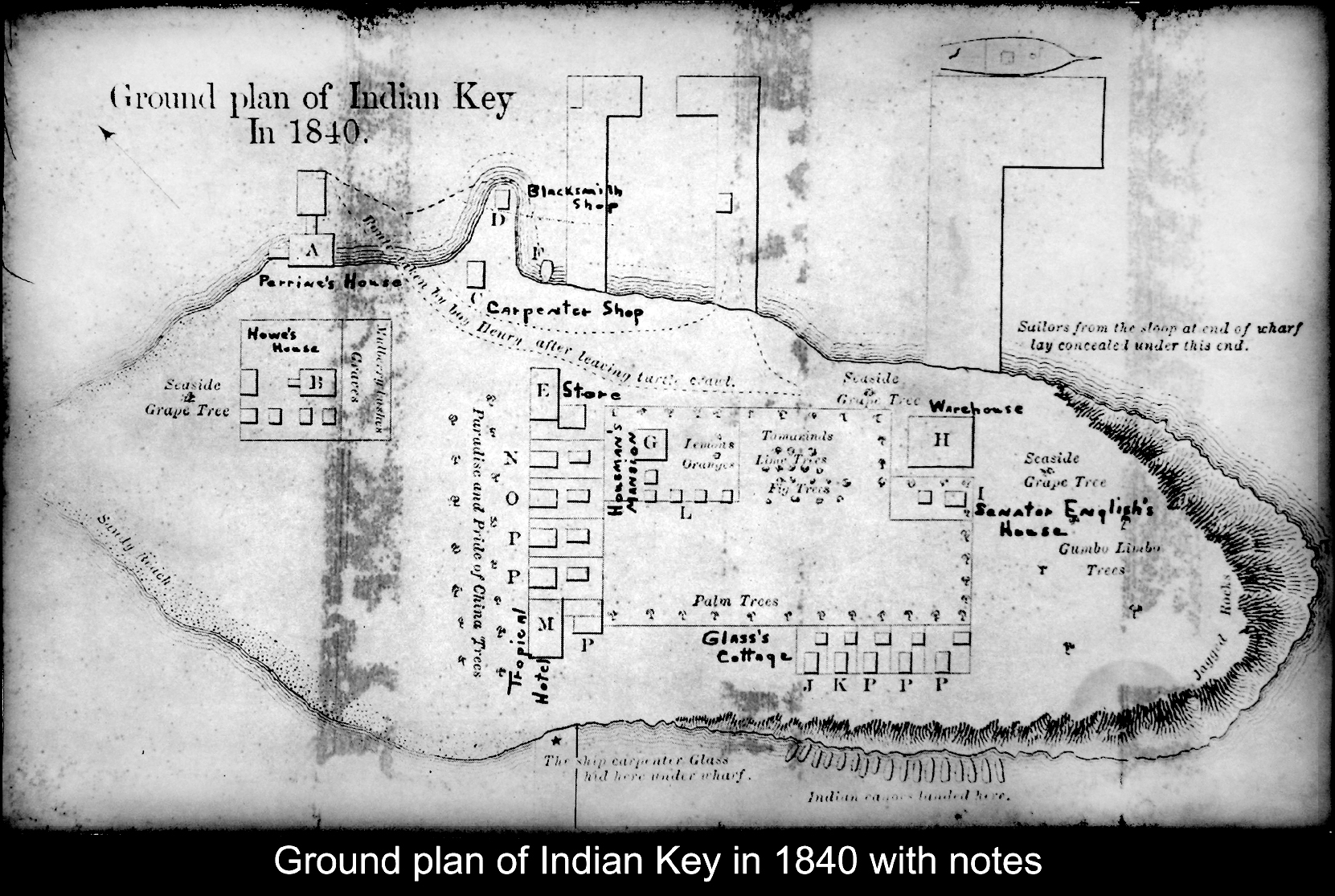
Before going much further, allow me to introduce my second National Archive Indian Key map for comparison. I could not align the first plan exactly horizontal so we will have some difficulty comparing, but once you acclimate to no streets it will be recognizable. This map seems more designed to show the Indian attack than be architectural correct. You will note some of the structures have alphabetical letters as if there is a reference legend, but I have never seen the legend that accompanies this image - I have seen this map pasted onto a larger sheet and legends affixed. This map is a tad more faded so the docks are not as legible as the first one - I have the positives and negatives of both, but this one may have faded since in my possession????
The bold hand printed words on this map are on the original and are correct. My guess at the legend is: A= the Perrine house, B= Mr. Howe's house, C= the carpenter house, D= the blacksmith's building, E= the store, F= where they were loading the plunder, G= Housman's house. H= warehouse, I= Senator English's house (?), J= Glass' house, L= where the Indians were laying, M= a rooming house or the Tropical Hotel, N=Mott's house, O= Smith and Sturdy's house, P= other cottages, probably un-occupied, and R= Maloney dock and bath house.
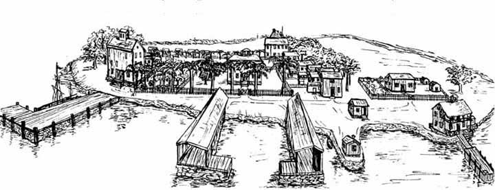
In conclusion, I suggest the top map is a promotional future map and the bottom map is more or less how it was before the massacre with a legend plus some written notes to explain the Indian attack. The boat drawn to the end of the single pier is a good clue. Had there been even one designated street at least one of the surviving letters and newspaper articles would have referenced it. The same applies to a business with the name Tropical Hotel. I conclude with a sketch made by Fran Atmus of her perspective of Indian Key.
- - - - - - - - - - - - - - - - - - - -
Use Back Arrow to return to reading Indian Key General History
