- By Jerry Wilkinson
- - Left click on any photo to slightly enlarge. -
 Eight to eleven miles southeast
of Florida City is a rare community. No one complains of unemployment
or
affordable housing. At one time over 100 people lived here and all had
waterfront homes. At its peak, about 30 were full time registered
voters. Few
millionaires can boast of a better view than the poorest resident here.
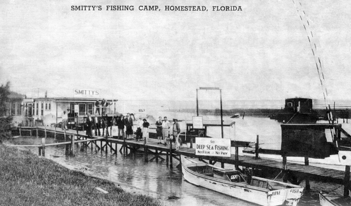
Back in
the 60s there were four acknowledged boat renters, bars and
restaurants: Smitty's, Bob
and
Lou’s, Alabama Jacks and Fred’s place - Capt. Earl Smith's Place
being the oldest. To my knowledge, none had
titles/deeds
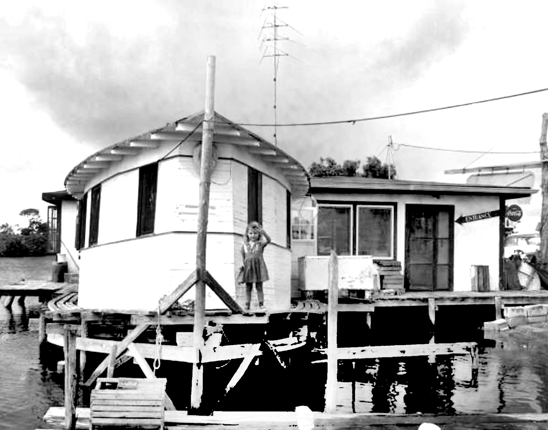
to their properties. The photo to the right is a postcard of the
community on the Dade County side of the fill circa 1959. It not
exactly on the Island of Key Largo, yet has a Key Largo ZIP code, but a
Homestead/Florida City phone number.
Eight to eleven miles southeast
of Florida City is a rare community. No one complains of unemployment
or
affordable housing. At one time over 100 people lived here and all had
waterfront homes. At its peak, about 30 were full time registered
voters. Few
millionaires can boast of a better view than the poorest resident here.
Back in
the 60s there were four acknowledged boat renters, bars and
restaurants: Smitty's, Bob
and
Lou’s, Alabama Jacks and Fred’s place - Capt. Earl Smith's Place
being the oldest. To my knowledge, none had
titles/deeds
to their properties. The photo to the right is a postcard of the
community on the Dade County side of the fill circa 1959. It not
exactly on the Island of Key Largo, yet has a Key Largo ZIP code, but a
Homestead/Florida City phone number.
It
started
like this: After the rejection of a Key West railway route via Cape
Sable in
1904, Henry Flagler in search of a deep water seaport hired William J.
Krome to
survey a route from Homestead to Turtle Harbor just off shore from
today's
Ocean Reef Club. Krome surveyed and platted a route southeast from
Homestead across the shallows between Little Card Sound and Barnes
Sound to North Key Largo headed to the coastline in
line
with Turtle Harbor. Before he completed this survey he was called to
St.
Augustine and directed to proceed with a railroad route down the Keys
to Key
West.
He
already
had a route surveyed across Little Card Sound to North Key Largo, but a
quick cost
analysis revealed it would be
better
to go across the Everglades directly to Jewfish Creek. This would be
much easier, shorter
and a narrower span of water to bridge than bridge across Little Card
Sound. What he did not
know was the
existence of Lake Surprise which later had to be bridged across in
addition
to
Jewfish Creek. Had he known of Lake Surprise, perhaps he would have
continued
with the Little Card Sound route. We do not know, so let's continue as
it was
done. 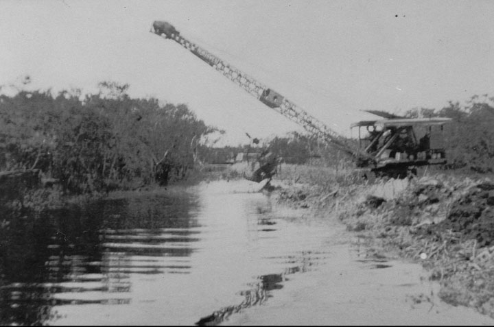
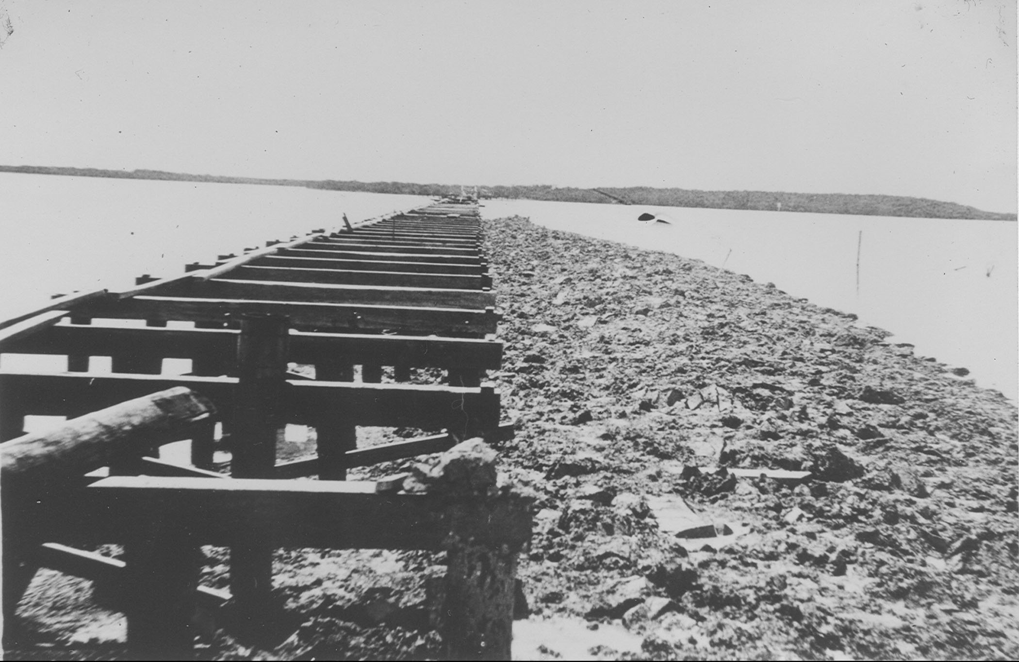
Then came the 1935 Hurricane destroying 40 miles of the F.E.C. Railway (The Key West Extension) and the water gap was eliminated by widening the old railroad bridges. The Card Sound route continued as before as the Gateway to the Florida Keys.
For us
in
the Upper Keys the improvement was the construction of the “18 mile
stretch”
over the original Flagler railroad bed. Once opened there was no need
for the
old Card Sound route as Ocean Reef was not yet even purchased, must
less
developed. Monroe County did not want to maintain the now seldom uses
wooden
Card Sound swing bridge, so the bridge was removed. Dade County then
cut back
on the maintenance of their part of SR 4A. Dade County did receive some
rumblings about the need to support the road for fishing purposes;
however,
maintenance was the absolute minimum. To facilitate the fishing group,
the
state made leases for co-called fishing camps, much like the feds did
for
hunting camps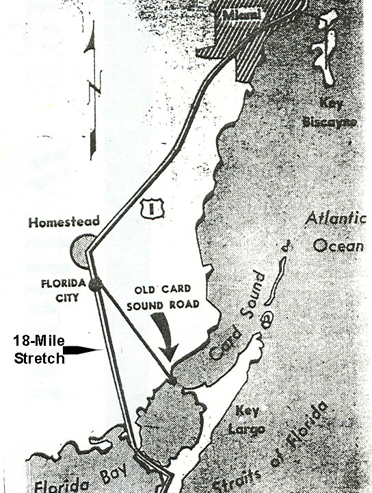 in the Everglades National Park.
One of those living there a decade ago was Doyle Green. At age 17, Doyle was dying of cancer at Jackson Memorial Hospital when he found God. Doyle is quoted as saying “The Lord turned the ceiling of the room into a TV screen” and “He told me he was going to give me new lungs.” Green would not live in Miami and moved to a shack he named Noah's Ark” at Card Sound where he began painting religious signs. One of the signs reads “Talking to God is better than Talking to your Yourself.”
A neighbor
of Green was Clarence Roberts and his wife, Loren. As many of the
others, they
make their livelihood from the surrounding waters, mostly selling blue
crabs.
On the eastern side of the county line, about a quarter of a mile of the causeway our to where the bridge use to be, belongs to Monroe County. Bob and Lou’s were most eastward of the camps. Bob and Lou Harris squatted, then leased on the causeway shortly after WW II, circa 1948.
Florida
Power and Light ran power out the causeway and Bob and Lou was the last
customer
on the route – the most eastern customer, but there was no public
drinking
water. They got along as all families did before the pipeline – water
cisterns
and when needed, or they hauled it in. Many of the residents travel
back and
forth to Homestead almost daily for various reasons; therefore,
bringing water
back is no real problem.
To the right is a 1959 photo of Fred's daughter, Frederica, at Fred's Place.
-
-
-
-
-
-
-
-
-
-
-
-
-
-
-
 -
--
-
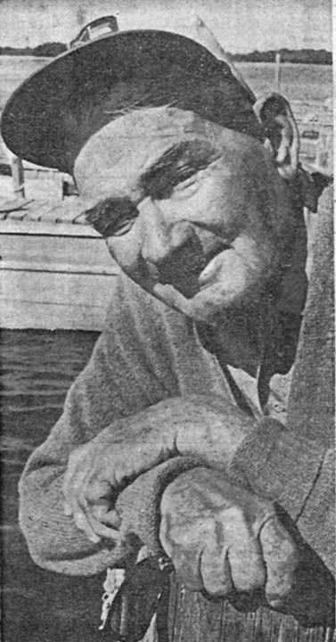
Jack and Alice bought the Card Sound lease in 1953 from a Miami plumber. Alabama Jack’s place is just across the county line in Monroe County and still has a lease. His initial intention was for a weekend place and a place to keep his boat. Soon there were seven boats and then an old railroad building as a home. After each hurricane, especially Donna in 1960 and Betsy in 1965, he remodeled with each one a tad bit larger.
The need for increased capacity via Card Sound is thought to have been the contributing factor for Dade County code enforcement in 1975 to evict all residents who do not have a current property lease. In June A Country-and-Western musical group, The Shade Trees led by Shade Stevens, performed a fund raising event at the Fred's Barn, owner Howard McQuaid, with over 100 attending raising over $1,000 to help fight the evictions.
Jack died in 1977 shortly after he and Alice moved to Homestead. He was buried near channel marker 27.
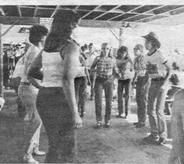
One of the later Alabama Jack’s owners was Don Sullivan who instituted a clogging band every weekend. See photo at the right. In 1980, Don sold to Rose Presti and if I am not out of date, I believe Phyllis Sague is the present owner.
Now political pressure is on to build the Card Sound/CR905 highway wider to better serve as an additional route to/from the Keys and especially to augment hurricane evacuation for the ever increasing development in Keys southward. Monroe County is supposed to be able to totally evacuate all residents, guests and tourists in 24 hours, or cease building new places.
Recently (2010) the state of Florida removed most of the residents based of the sovereign State of Florida land rights and lack of a general warranty deeds. Alabama Jacks did survive and life goes on.
To return to the Specific Locations and Keys homepage, Click HERE.